al a carte Itinerary
Daily Activities: Each morning, participants will prepare their own breakfast before heading out for the days activities. There will be a more detailed booklet for participants to see what there is to do between the departure and the overnight location and supper. If people are interested in golf this guide will identify what courses are betwen departure and the evening.
Evening Meals: The plan is to arrange a variety of catered meals provided each evening between 6 – 7 pm near the camping area.
Special Activities: There will be a few group activities planned i.e. Horse Back Trail Ride, Tour of Hydro Dams, Jet Boat Picnic near waterfalls, pontoon boat rides, chain saw carving competition, tour of historic Barkerville, steam locomotive excursion, etc.. The general plan is to allow participants to create their own adventures, then share stories and photos together around an evening meal.
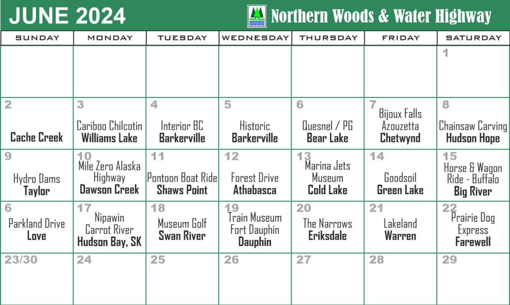
Draft Itinerary
NOTE: The West-to-East Cavalcade rally at Cache Creek on June 2nd and start the 2024 tour from that point, then travel north through the interior to Prince George then north-east onto Dawson Creek. The cavalcade will then travel eastward through northern Alberta, Saskatchewan, and Manitoba before turning southward toward Winnipeg. See daily Itinerary including photos.
The East-to-West itinerary travels from east to west overnighting in some different communities and slight variations of the route. It will start near Winnipeg, then meander into northern Manitoba before turning westward into northern Saskatchewan, then onto Alberta to Dawson Creek, and NE BC. We then head southwest to Prince George, then onto BC interior’s Cariboo-Chilcotin to Cache Creek. It has been determined to end the 2023 Cavalcade at Cache Creek on July 13 we bid farewell.
